

Introduction
Welcome to our online public consultation website for a new residential development at Wilcoxholm Farm on the south eastern edge of Linlithgow. The site is allocated within the West Lothian Local Development Plan (‘LDP’) 2018 as a residential site (LDP ref: H-LL 11). This pre-application consultation process follows the submission of a Proposal of Application Notice (‘PAN’) by Hallam Land (‘the Applicant’) to West Lothian Council (‘WLC’) on the 3rd of July 2024 (portal ref: 0508/PAC/24).
This website is in addition to a minimum of two in person public exhibitions which will be carried out in accordance with the Planning Regulations. The first event was held on Tuesday 29 October 2024 between 13:00 – 18:45 at the Low Port Centre, 1 Blackness Road, Linlithgow, EH49 7HZ. The second event will be held on Tuesday 27 May 2025 between 13:00 - 18:45 at the Low Port Centre, 1 Blackness Road, Linlithgow, EH49 7HZ. The website will remain available to view throughout the pre-application consultation process.
The purpose of this website, and the in person public exhibitions is to allow the local community an opportunity to ask questions, engage and comment on the emerging proposals for the site. Members of the design team are in attendance at the in person public exhibitions to talk you through the proposals and answer any questions you may have, and are also available to review and respond to any questions received via alternative contact means.
Both West Lothian Council and the Scottish Government declared a housing emergency in May 2024. Hallam Land believe this is as a result of the long term underprovision of both affordable and private housing.
Site Location
The site sits on the south eastern edge of Linlithgow and comprises the H-LL 11 housing allocation. This application relates predominantly to the land to the south of the Union Canal which runs through the middle of the site on an east / west alignment. The site is accessed from the B9080 to the south, and is bounded to the west by existing residential development. To the east is the existing Wilcoxholm Farm and associated farmland.

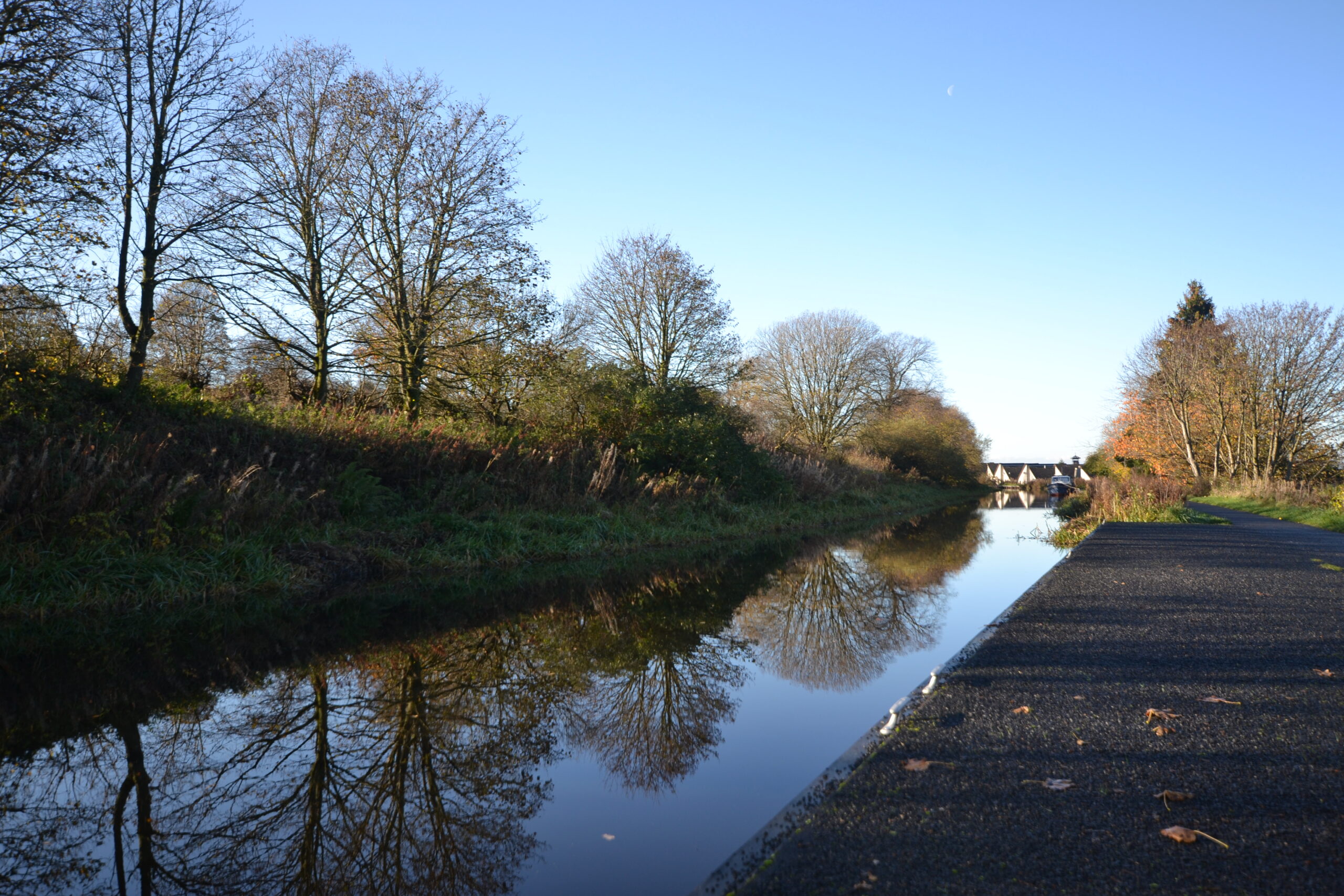
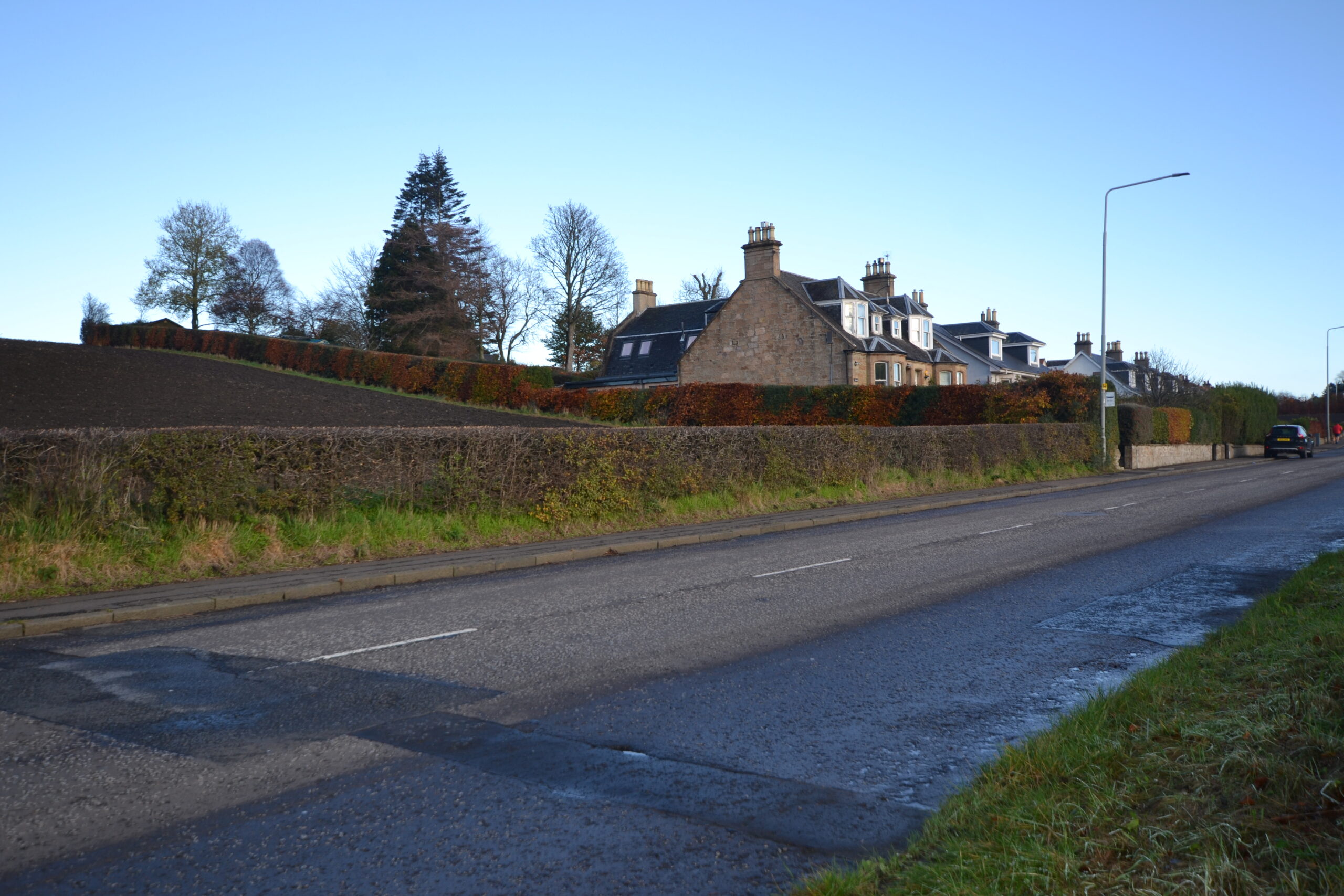
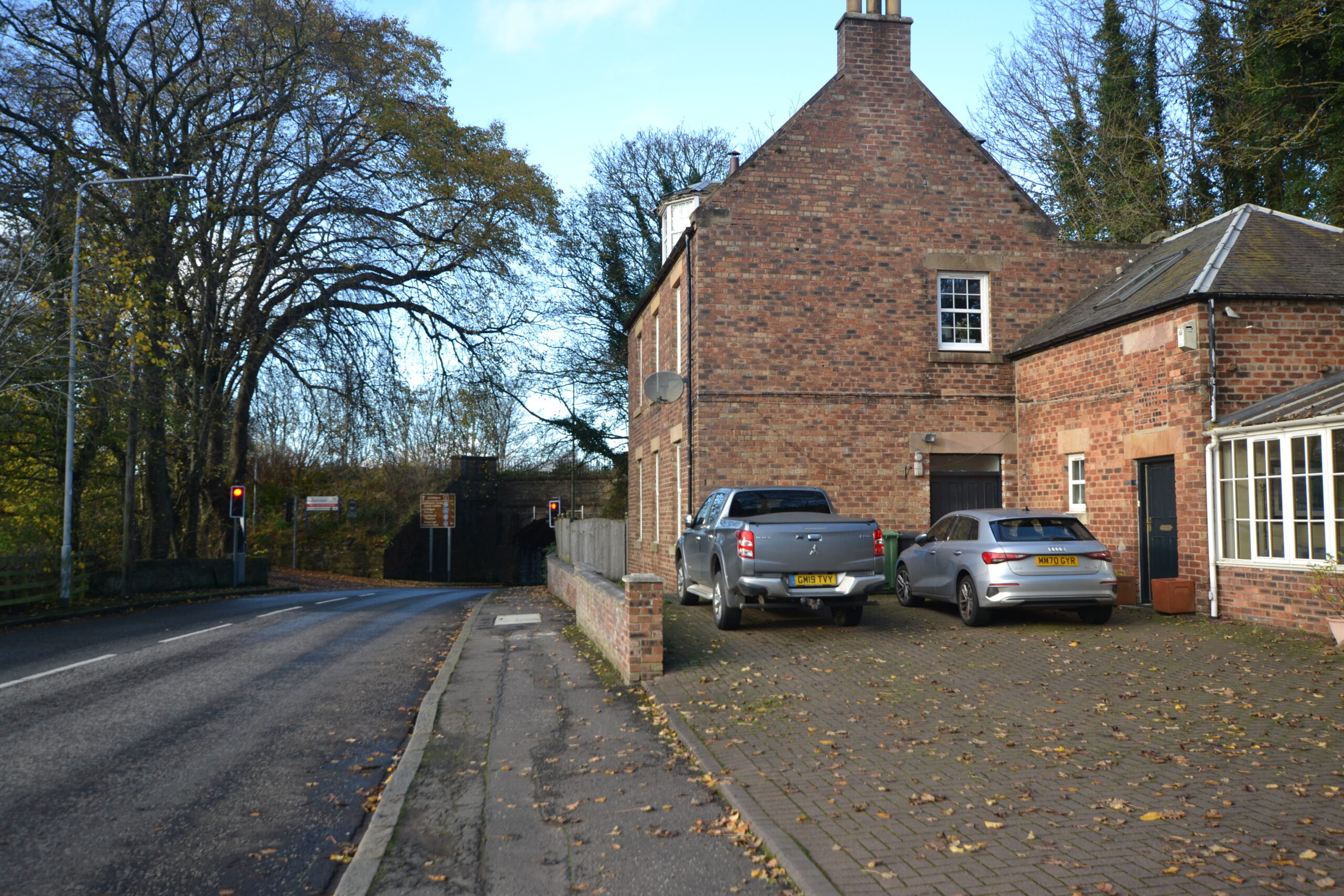
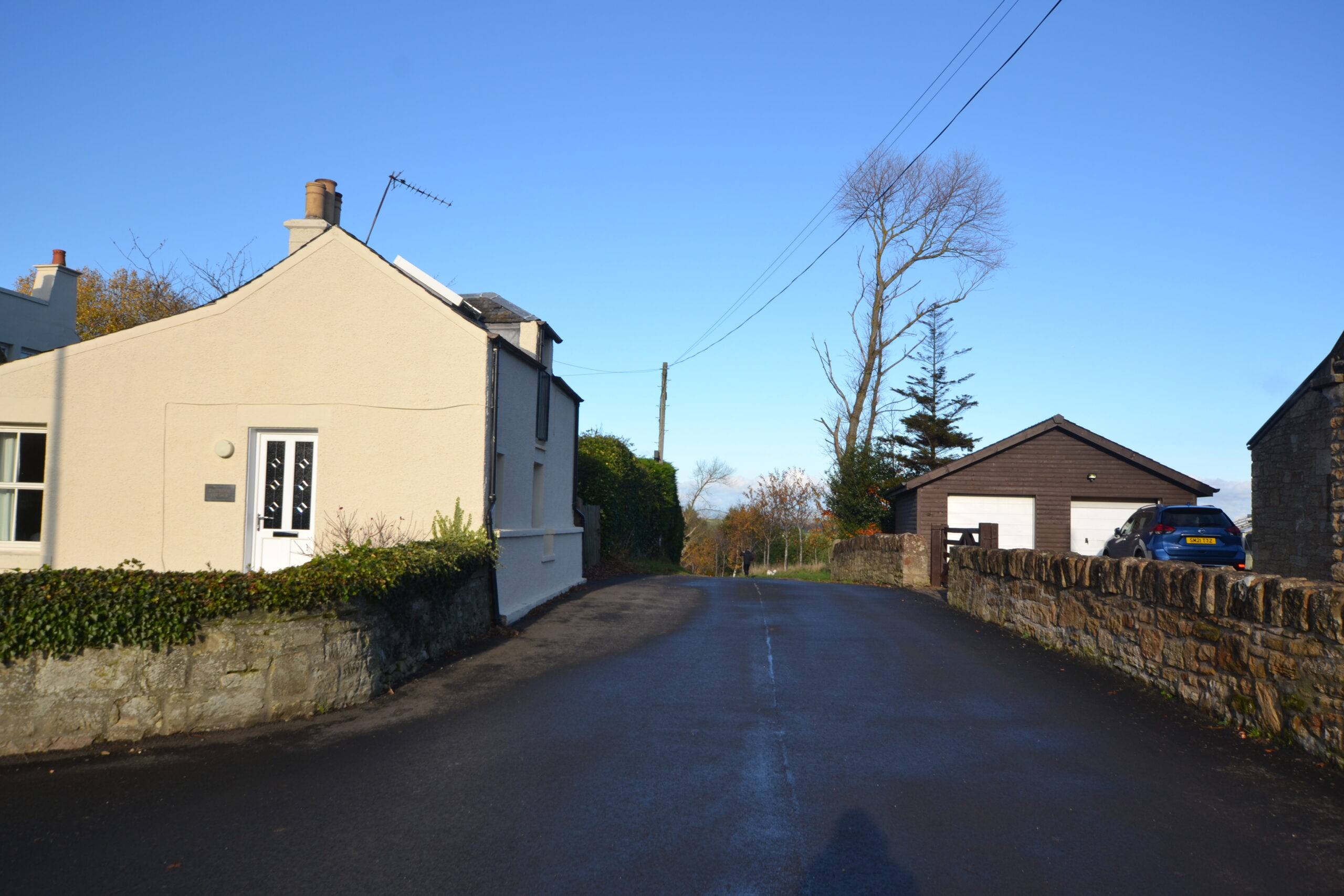
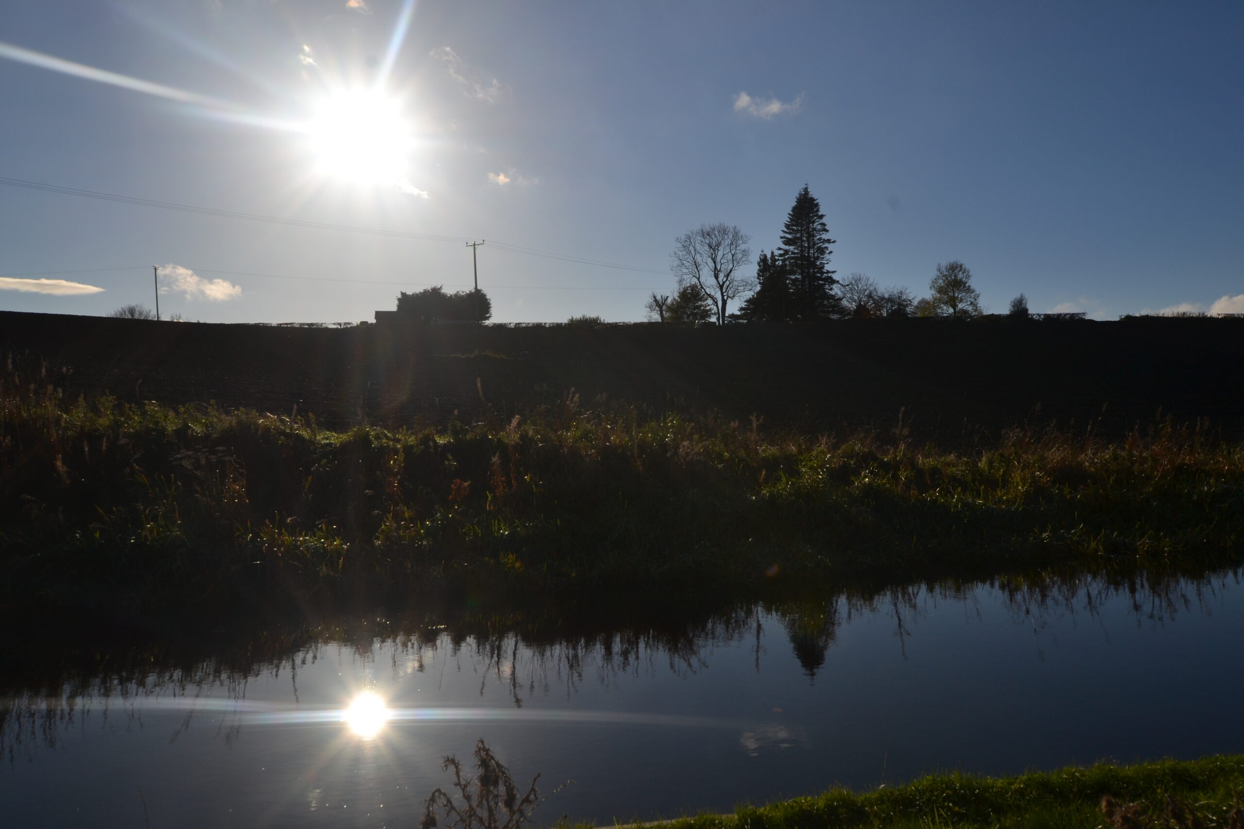
Site Photography
-

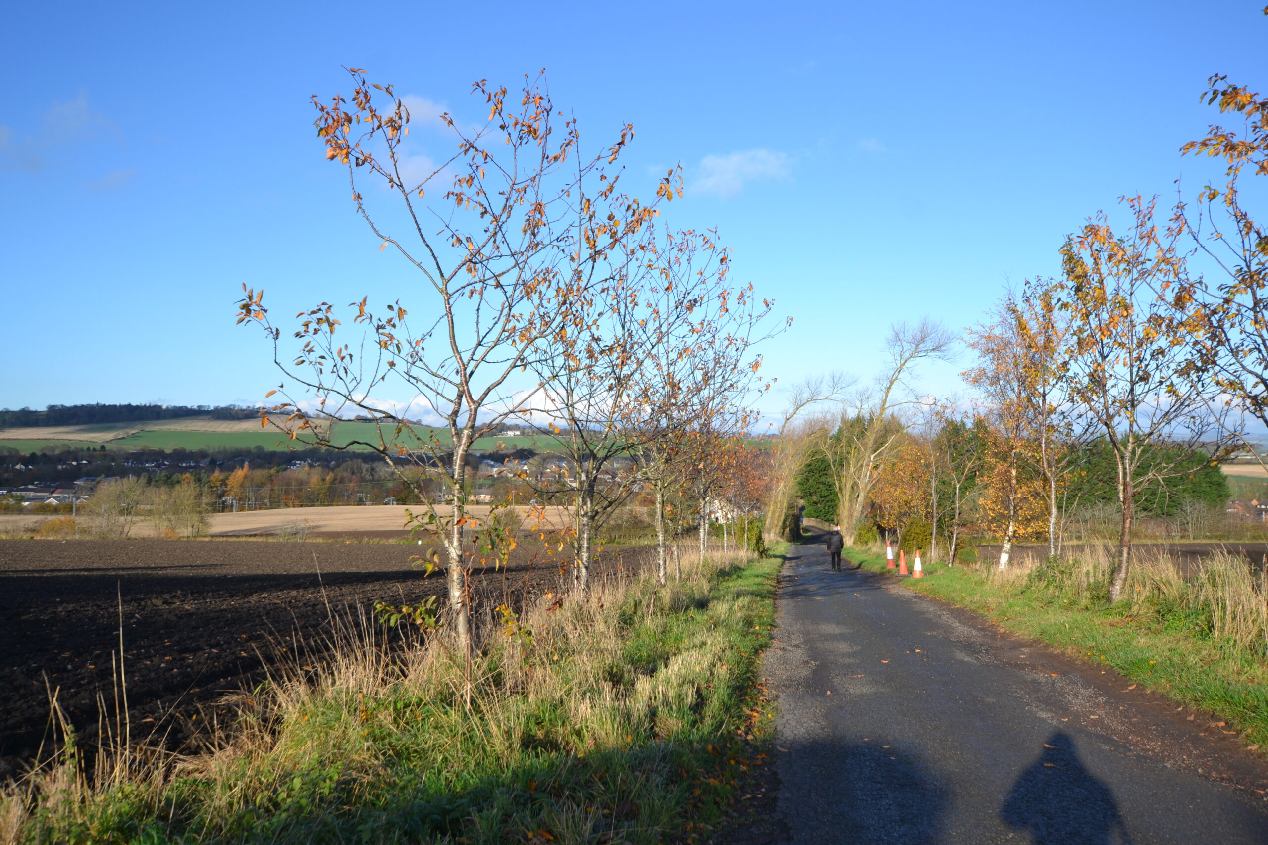
- Union Canal Towpath into Linlithgow
-
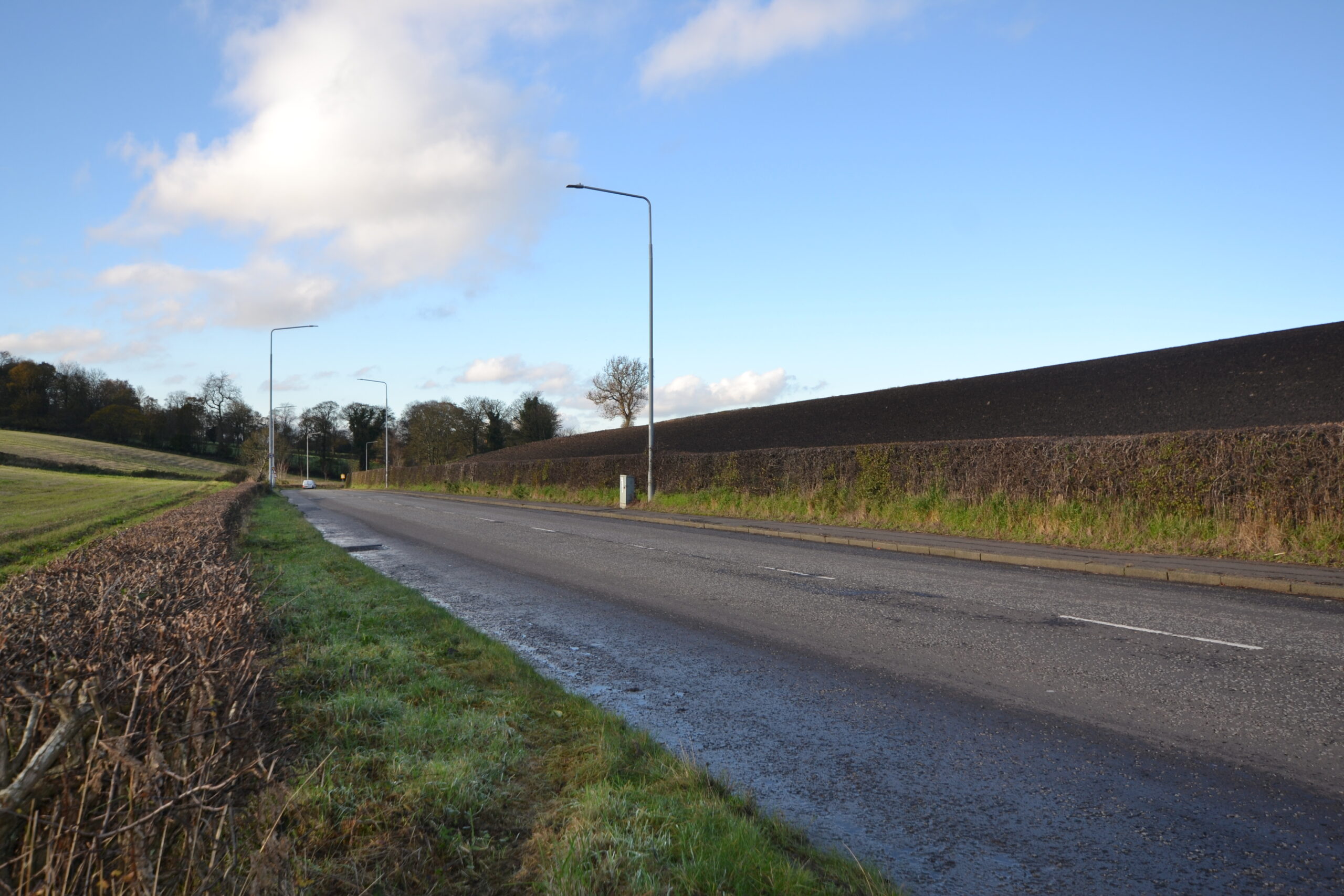
- Existing Housing Along B9080
-
- Existing House at Canal Bridge on Western Edge of Site
-
- Existing Houses Either Side of Farm Access Road along Eastern Boundary
-
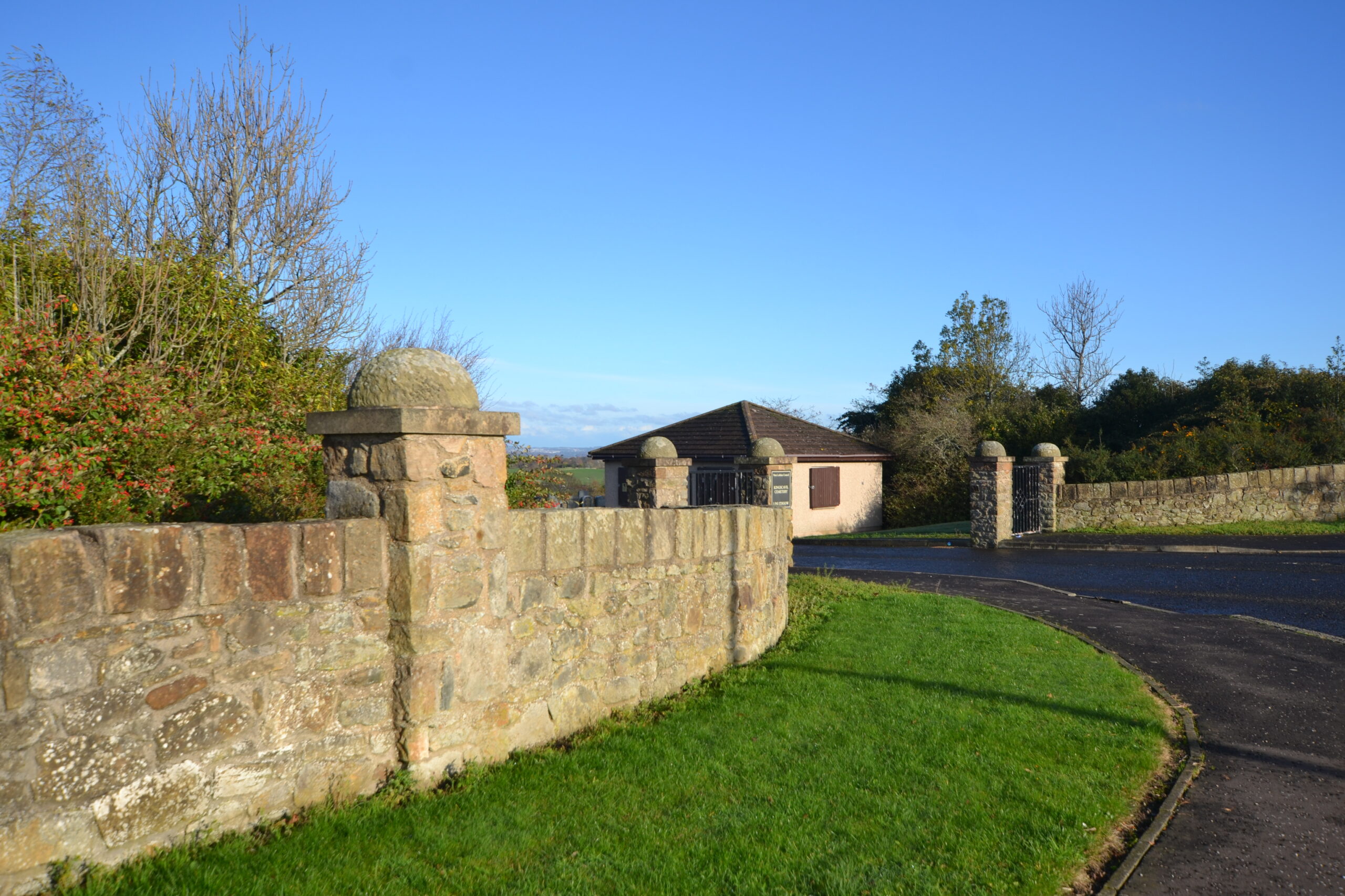
- Existing Access to Cemetary from B9080
-
- View Over Site to North West from B9080
-
- View North Over Site from Farm Access Boundary Road Along Eastern Boundary
-
- View West Towards Site from B9080
-
- View South Over the Site from Union Canal Towpath
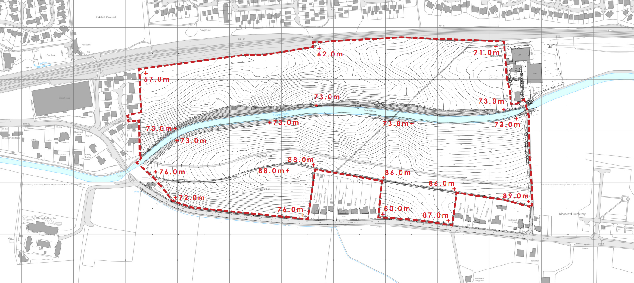
Site Topography

Planning Policy Context
The development plan for the site comprises National Planning Framework 4 (‘NPF4’), adopted on 13 February 2023 and the West Lothian LDP, adopted on 4 September 2018.
In addition, Linlithgow is covered by a non-statutory Local Place Plan (‘LPP’). LPP’s are community led plans that were introduced by The Planning (Scotland) Act 2019 to encourage communities to be more active participants in planning for their futures.
Local Development Plan 2018
The site is identified within the adopted West Lothian LDP 2018 as a site for housing. The LDP estimates a site area of 20ha and capacity of approximately 200 units. However the capacities identified are indicative only and sites require further design and analysis to establish an appropriate development density. The LDP also identifies the following requirements for the masterplan:
- Junction improvements
- Canal bridge crossing required
- Provision of pedestrian access from the canal to the railway station required
- Capacity issues relative to Low Port Primary School and Linlithgow Academy require to be addressed
- Flood Risk Assessment required
- Archaeological Assessment may be required
- Airport restrictions to be observed
- Coal mining investigation may be required
- Proposals must be sensitively designed to respect the Union Canal which is a Scheduled Ancient Monument
- Investigation into existing houses on the Edinburgh Road and potential connection to mains drainage and other utilities
These matters will be fully addressed as part of the proposal and subsequent planning application(s).


Local Place Plan 2024-2034
Linlithgow also benefits from a Local Place Plan which has been prepared in accordance with latest planning guidance to inform any future Local Development Plans. The pro-active document has been produced by local people (in this case the Linlithgow Planning Forum) who want to have a ‘positive influence on the future planning of development in their area’.
Whilst the purpose is to inform the LDP, it is the intention of the Applicant and the design team to take cognisance of the plan and engage with its members moving forward.
Preliminary Design Concept
Indicative Site Layout
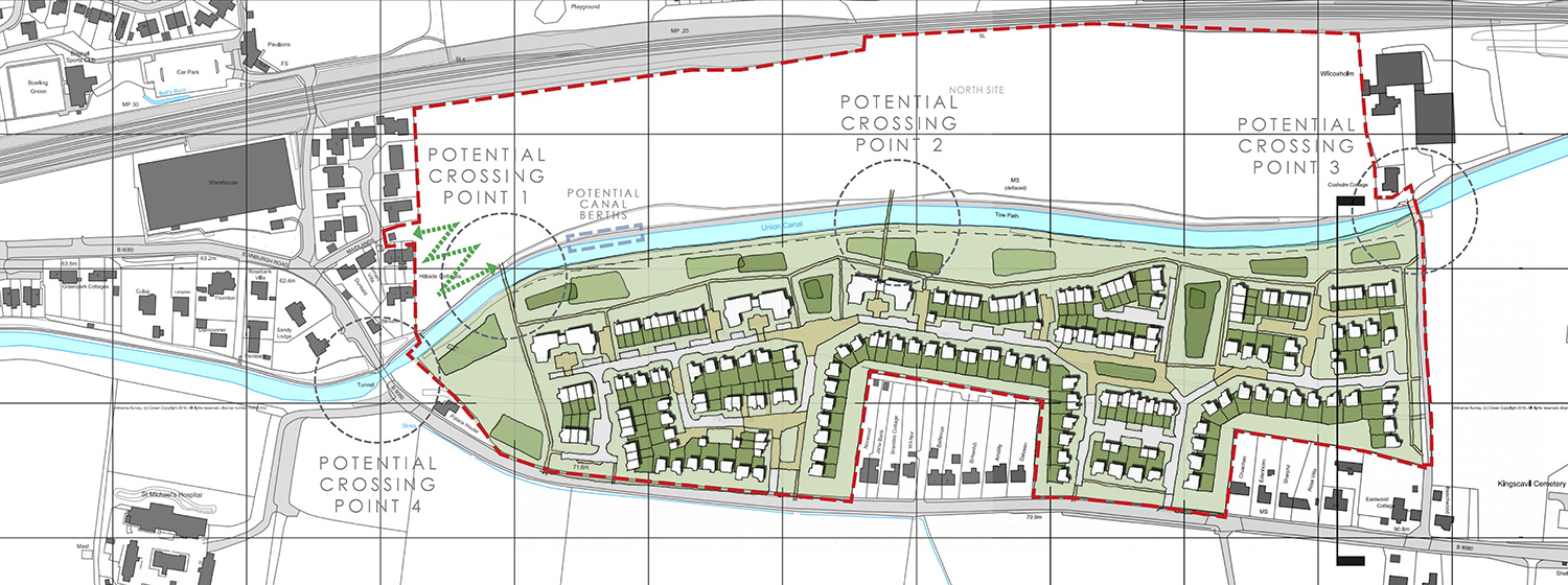
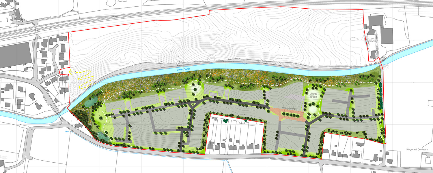
The draft Indicative Site Layout below sets out an example of how housing could be accommodated within the site. The layout includes a variety of housing types right from 1 – 5 bedroom homes, including flats (up to max 2.5 storeys), terraced houses, semi-detached houses and detached houses. The proposed development is expected to provide up to 220 homes, which will include affordable housing provision at 25% of the overall number of homes. It is important to note that the application is for Planning Permission in Principle, and therefore whilst this planning application will look to establish overarching principles for the development of the site, the full and final detail of the site layout would not be determined through this application, but a future application for Approval of Matters Specified in Conditions (‘AMSC’).
The Indicative Site Layout creates a more positive environment along the Union Canal and improving connectivity into Linlithgow. This includes new open space and play areas along the canal, which will improve biodiversity and provide views out of the site to the north and west. The topography also suggests this is the right approach to minimise retention. The LDP identifies a requirement for an additional crossing point over the canal which will also be part of the emerging proposals. Hallam Land are keen to hear feedback from the local community on the preferred bridge options, which are each set out in further detail below.
Indicative Layout with Crossing Options
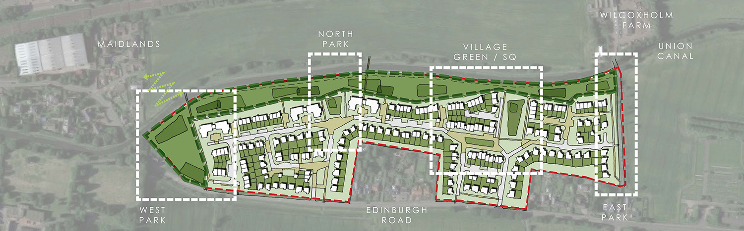
Character Zones
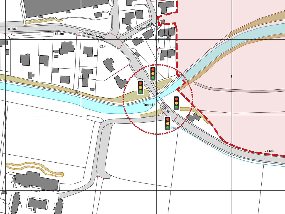
Union Canal Crossing
The LDP allocation for the site makes reference to the requirement for a canal bridge crossing as part of the development of the site. As set out above, Hallam Land are keen to get feedback from the local community on the preferred bridge options for the proposed development.
There is already a crossing over the canal at the eastern end of the site. The existing stone, vehicular bridge was designed by Hugh Baird circa 1820 and is a category B-listed structure. It is primarily used to service the farm but is already utilised by pedestrians as a means of accessing the towpath on the northern side of the canal.
This existing crossing could continue to be used as a crossing point for the residents of the new neighbourhood at Wilcoxholm Farm. Improvements could be made to the steps and ramp which currently lead from the bridge to the towpath to make the route more accessible for all. This option would represent the most sympathetic intervention along the canal - which is also a Scheduled Ancient Monument (‘SAM’).
Other options include the provision of a new crossing in the central part of the site, or at the western boundary close to the existing bridge over the Edinburgh Road. These would need to achieve a minimum clearance over the canal for pedestrians and canal barges. They would also need to consider wheelchair access. There is also potential to amend the sequence of the traffic lights at the existing canal bridge to allow for a pedestrian only phase.
We have already engaged with Scottish Canals who will be consulted on any proposals as part of the application process.
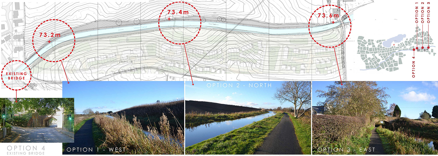
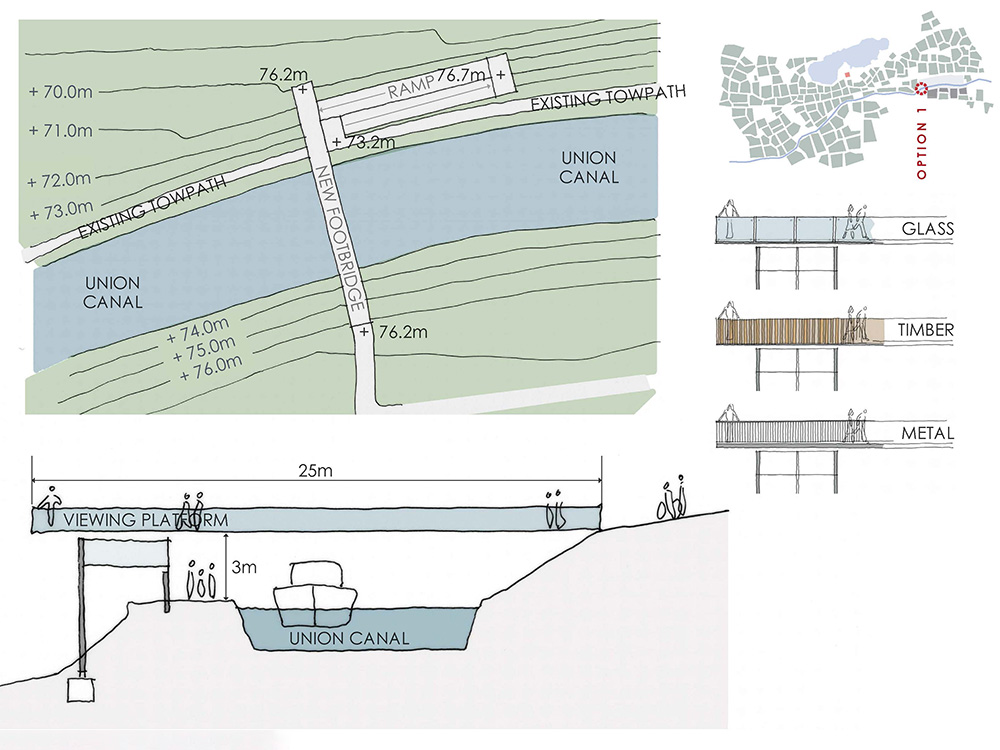
Option 1 - West
Option 1 shows a new crossing on the western boundary of the site and at the closest point to the existing settlement and houses within Linlithgow.
The proximity to the existing settlement is a positive in terms of connectivity and improving links into the town. However the canal sits much higher than the site to the north and the existing houses on Maidlands. Any structure over the canal needs to have a clearance of approximately 3m and so will sit much higher than the existing ground ground level. There are potential overlooking and privacy issues with a crossing in this location and at this height.
This is also the most visually obtrusive option being the closest to the existing houses and the historic town. It is likely that a crossing in this location would be visible in long views towards the site from the existing town centre.
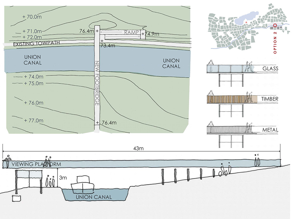
Option 2 - North
Option 2 shows a new crossing at the centre of the site and where the levels are least challenging in relation to the proximity of the canal.
The photograph above illustrates the relatively gentle slopes to the north and south of canal. This means that the level on each side of the canal is almost the same, with a slight slope up in the south and a slight slope down to the north.
As any bridge over requires a clearance or headroom of approximately 3m it would sit much higher than the existing ground ground level. However due to this location being furthest away from the houses on Maidlands in the west and the farmhouse in the east, there are less issues with overlooking and privacy to existing properties. The length of the bridge in this location would be longer at approx. 43m.
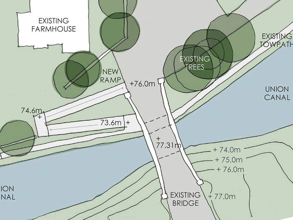
Option 3 - East
Option 3 shows improved accessibility to the existing bridge rather than proposing a new crossing over the canal. This has the potential to be the least problematic option to cross the canal.
The canal is a Scheduled Ancient Monument ('SAM') and its setting is protected by various legislation and planning guidance. This is implemented by Historic Environment Scotland ('HES') and Scottish Canals. The existing crossing presents the best option to protect the setting as the building already exists. It is also part of the historic setting and is separately protected by a category B-listing. The footpath down from the bridge to the canal could be upgraded as part of the development.
Although this has the potential to be the best option to protect the setting, it is the least attractive in terms of location. All of the new and existing residents of the site would have to travel to the eastern part of the site to cross the canal. This has the potential to add 5 minutes to journey times.
Option 4 - Existing Bridge
Option 4 shows improved pedestrian and cycle accessibility under the existing bridge rather than proposing a new crossing over the canal.
This would involve a change in the priority of the existing traffic lights under the bridge.
Both sides of the bridge would be red for vehicles for an appropriate length of time. This would allow pedestrians and cyclists to pass under the bridge safely and without vehicles.
This could be seen as a good compromise, both to improve safety for pedestrians and cyclists and avoid any new structures over the historic canal. It could also be incorporated in addition to one of the other options.
Landscape Framework
We have set out below a draft illustration of the evolving Landscape Framework for the site. This illustrates that the site will contain substantial areas of open space, which will be planted with a variety of new trees, hedgerows and shrubs, as well as a variety of planting, helping not only to provide an attractive new place which fits well in the landscape, but which also provides substantial biodiversity enhancement.
Feedback from First Public Consultation Event
The first public consultation event was held in the Low Port Centre on 29 October 2024. The event was widely publicised, including a newspaper advertisement within the Linlithgow Gazette, over 1,700 leaflets delivered to local households and direct invitations sent to the local community council, local councillors, constituency MP and MSP.
The first event was attended by over 200 people, primarily comprising local residents, as well as local councillors and representatives of the community council.
A variety of feedback was received on the day of the consultation event, as well as in the Intervening period via the online public consultation website, which can be viewed here.
What Happens Next?
Have Your Say
Thank you for taking the time to view our online public consultation website. We value any local knowledge and / or opinions and encourage members of the public to provide us with feedback on the proposals, which will be considered by our project team. We welcome online questions and feedback submissions and you can also get in touch directly.
Alongside this public exhibition the project team is progressing discussions with WLC and other stakeholders regarding the proposals. The second exhibition will consider all feedback received in relation to the first event, and include further design development to take account of community feedback. All feedback in relation to the second consultation event should be sent via the abovementioned methods by 27 June 2025.
Following the conclusion of the pre-application consultation phase, the Applicant will collate all comments received in relation to both public exhibitions and amend the proposals to take account of the feedback, where possible. We will then submit a formal planning application to WLC later in 2025.
Ask a Question
"*" indicates required fields